Geographic Information Systems – Task 1 and 2 of 4
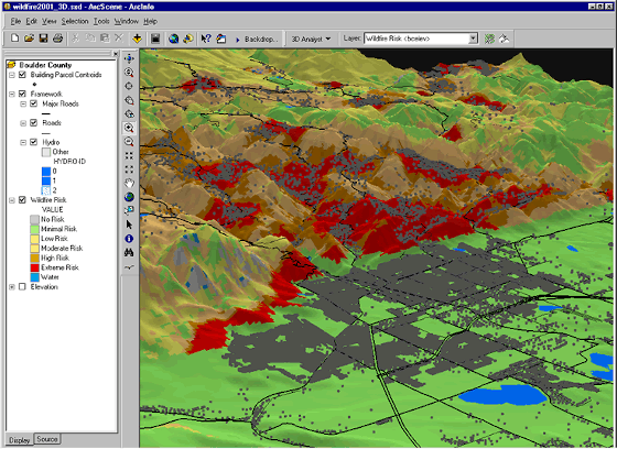
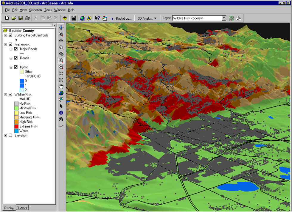
Please examine the map of Boulder, CO, displayed in ESRI ArcGIS carefully!
When creating a map with GIS, often only a selection of the information available is displayed, depending on the intended purpose. This map was modified to draw attention to the following layers: buildings, streets, emergency routes, evacuation centres, and fire scenarios.
Task 1: For which purpose would such a map be most suitable?
Task 2:Concerning the street layer: Which additional attributes would be most useful for a map referred to the purpose given before?